
Find Jersey City Neighbors
A block question needs a source for each part of the answer. The city-linked parcel layer places nearby properties in relation to a target address. The assessor supplies an assessment parcel and owner-name lead. The Register supplies recorded interests and legal descriptions. Public association pages can identify a group contact or activity location. None of those sources turns a block into a complete list of residents, and a named owner or party may not live at the property.
| Source | What it shows about a block | Access |
|---|---|---|
| City-linked ArcGIS Parcels | Parcel geometry, block/lot, address and owner aliases, select tax and building fields. | REST service, with last-edit date noted. |
| Jersey City assessment search | Property location, owner-name lead, block/lot, class, and assessment context. | TaxRecords-NJ or assessor office. |
| Hudson Acclaim | Recorded party, legal description, instrument, book/page, date, and consideration. | Online index or Register search area. |
| Public Adopt-a-Lot examples | Named civic-group public contacts and activity locations. | City public page, without member lists. |
| Historic directory and map resources | Dated address or building context for a prior block question. | JCFPL New Jersey Room and collections. |
The most useful phrasing is “records associated with nearby parcels on the stated date.” It does not overstate owner, voter, directory, or group information as proof of a current neighbor relationship.
Jersey City Parcel Fields
The city-linked ArcGIS Parcels service is the starting map for Jersey City neighbors research. Its schema includes parcel geometry and fields for block, lot, qualifier, location, owner aliases, class, land and improvement values, sale date and price, map page, building description, zoning, year built, square footage, type/use, and basement. Helpful identifiers include M4_Block, M4_Lot, M4_Qual, M4_Locatio, M4_Owner_N, and M4_New_Add.
The parcel REST schema makes the available Jersey City block and address fields visible before a researcher interprets any map hit.
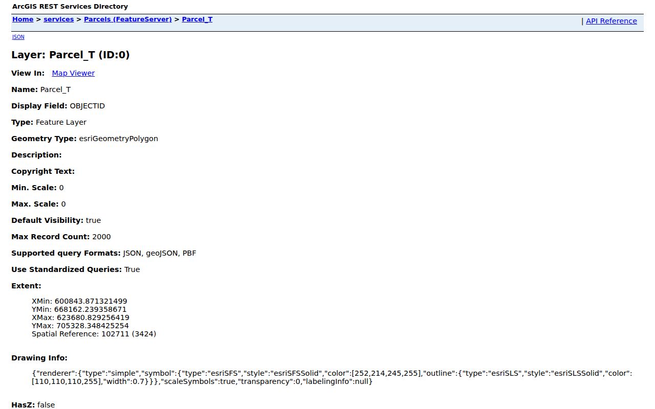
The image documents the field structure, not the identity or current status of a household. It is safest to copy the block, lot, source date, and relevant field labels into a research note.
Map a Jersey City Block
Walk the immediate block by parcel geometry rather than by a broad name search. Begin with one normalized address and identify its mapped parcel. Read the adjoining polygons and their block/lot information, then confirm each relevant parcel in the live assessor system. For recorded-title context, use Acclaim’s legal-description search with municipality, block, and lot. The full named-street chain is different work and is available through the Jersey City street directory.
- Locate the target address in the parcel layer or assessment search and retain the municipality, block, lot, qualifier, and source date.
- Inspect the immediately touching or nearby parcel polygons, not every address that shares a postal zone.
- Use TaxRecords-NJ to verify the parcel lead and keep owner and physical-location labels distinct.
- Use Hudson Acclaim for a recorded instrument, checking party role, legal description, date, and document type.
- Stop at the record boundary. A parcel owner or recording party does not establish who currently lives there.
This short flow produces a reproducible parcel record: address to geometry, geometry to block/lot, block/lot to assessor or deed, then live verification. It avoids treating postal boundaries or commercial category results as a substitute for the map.
Jersey City Parcel Date Limit
The ArcGIS parcel service reported a last data edit of November 14, 2022 and a maximum response of 2,000 records. Both details matter. The service can orient a Jersey City block, but it may not reflect a later split, address change, assessment update, or transfer. Use a small map area and verify live information through the assessor. Use the Register for recorded instruments rather than relying on a stale owner field.
One parcel can also have multiple address forms. Preserve the service field and the query used. When a map, assessor, and instrument disagree, record the conflict and confirm it with the relevant office instead of choosing the most convenient value.
Jersey City Neighbor Address Forms
Nearby parcel work can fail when a street has an abbreviated or historic form. Jersey City’s permit guidance recommends shorter searches because historical GIS records can vary. Try both 280 Grove St and 280 Grove Street, or 342 MLK Dr and 342 Martin Luther King Jr. Drive. Keep every form in the research note so the query can be repeated later.
A corner property may have a historic address on the cross street. Compare map sheet, block/lot, legal description, and older municipal label before treating two forms as the same parcel. A ZIP code is not the deciding field for adjacency.
Jersey City Public Group Contacts
The city’s Adopt-a-Lot material offers public civic contacts that can add community context without exposing membership. These are organization locations and public channels, not evidence about the households that support, attend, or live near a group. Use the city page or the organization’s public contact method for an activity or neighborhood question.
Riverview Neighborhood Association
Ogden’s End Community Garden, 105 Ogden Avenue, Jersey City, NJ 07307.
Greater Neighborhood Alliance
81 Garfield Avenue, Jersey City, NJ 07305.
Union Street Block Association
Mandela lot, 447 MLK Drive, Jersey City, NJ 07304.
The city’s public examples identify these groups and locations as a civic resource.
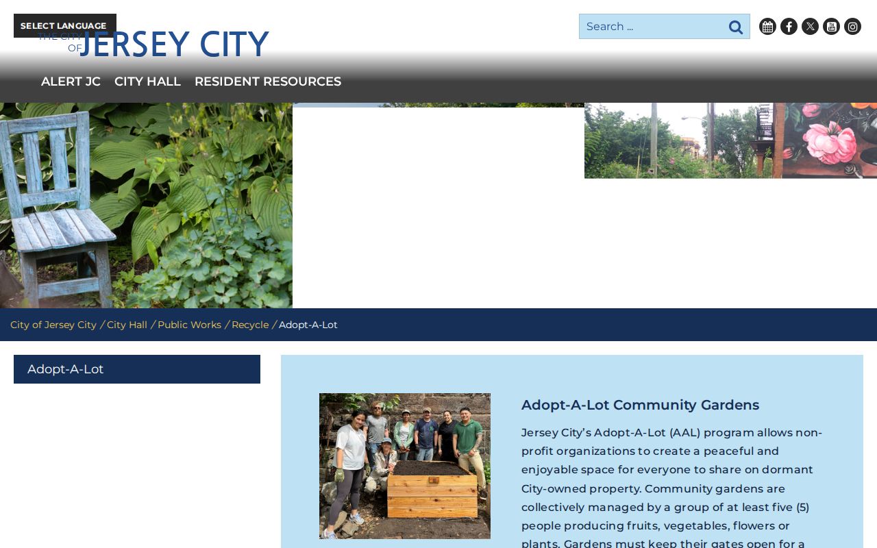
Public group contact does not equal a membership directory. Keep the description organizational and use a public meeting, cleanup, or contact channel only as the group provides it.
Jersey City Voter List Limits
Voter information is not a block census. New Jersey’s registration status route is for the registrant, while Hudson County election offices handle list or district questions. N.J.S.A. 19:31-18.1 provides for voter-list copies on request at $0.25 per copy of a list of voters per election district and restricts commercial or charitable solicitation use. Original registration forms have tighter limits, and voting history retention does not mean an unrestricted online lookup.
For a lawful district question, identify the election, county, municipality, ward or district, and requested list type with the Hudson County Board of Elections or County Clerk. Do not request or reproduce dates of birth, signatures, ID values, or bulk files. An inactive status reflects an address-confirmation process, not a conclusion about a person’s residence.
Jersey City Recording Alerts
The Register’s free Recording Notification Service can monitor a name, address, lot, block, or municipality for later recordings. It is a forward-looking bookmark for a Jersey City parcel question, not a way to find old documents or identify neighbors. Enrollment needs an email, identifying information, and a monitor type. Exact spelling variants should be entered separately, and subscriber names and emails may be subject to disclosure.
The RNS enrollment route displays the monitored-name, address, block, lot, and municipality options.
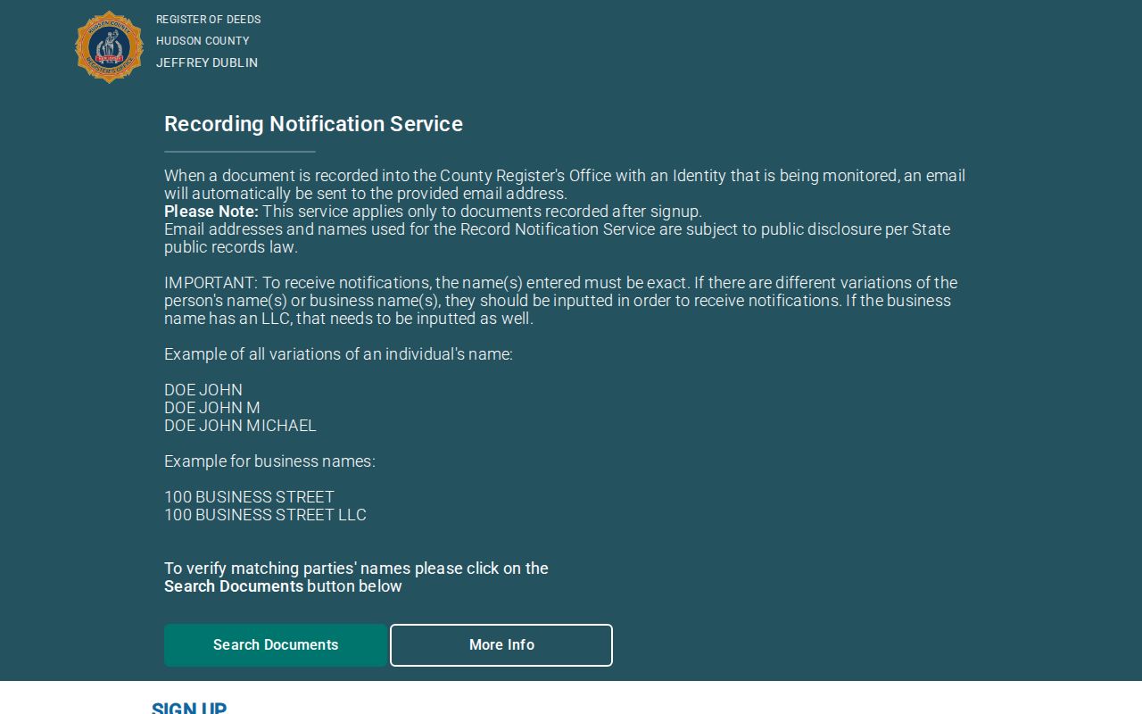
An alert only reports a document recorded after enrollment. If an alert appears, check the instrument and its legal description through the Register before drawing any conclusion.
Jersey City ZIPs Are Not Neighbors
ZIP Codes are postal delivery designations, not parcel, ward, neighborhood, or block boundaries. USPS says that a ZIP result does not confirm a person or company at an address. The official Jersey City ZIP map can provide city-facing geography, but the USPS address lookup is the authority for current delivery formatting. Neither source establishes an adjacent parcel or a household relationship.
For Jersey City neighbors work, use address, block/lot, municipality, and geometry. Use a ZIP only to normalize a postal address. This keeps a postal zone from becoming a false claim about a block.
Jersey City Block History
A block also changes over time. Jersey City historic-preservation material describes consolidation of Hudson City, Bergen City, and Jersey City in 1869-70, then Greenville’s addition in 1873. A historic map or directory can therefore use a place name that differs from a current parcel record. The Ward D architectural survey adds local physical context: Hudson City South was platted by 1873 and built up by 1896.
Pair a historic directory listing with a Sanborn sheet before using a dated block description. The map can show a building footprint, use, fire wall, hydrant, or street orientation. It cannot establish a modern neighbor relationship or tell who resides there now.
Jersey City Neighbor Sources Compared
Official sources disclose their keeper, record type, and limits. Commercial neighbor-lookup categories can be convenient, but they commonly collapse records of different dates and roles. Treat a category result as a prompt to verify, never as proof. The responsible city, county, library, or state custodian remains the route for an actual record.
| Source type | Best use | Boundary |
|---|---|---|
| Official parcel, assessor, and Register records | Identify a parcel, recorded interest, date, and custodian. | Fields can be stale or show an owner or party rather than a resident. |
| Library maps and directories | Place an address or printed entry in a particular historic year. | They are dated evidence, not current occupancy proof. |
| Commercial neighbor-lookup category | Spot a lead that requires independent checking. | May combine uncertain, outdated, or mismatched records without the custodian’s context. |
Note: Preserve source URL, access date, parcel key, record type, role, and uncertainty so a later researcher can repeat the official search.
Limits on Jersey City Neighbors
Some expected information is private or lawfully redacted. New Jersey’s Address Confidentiality Program may provide a substitute address for qualifying participants. Daniel’s Law supports address redaction for covered public-safety people and immediate household members. MVC personal information has separate restrictions. OPRA does not override a specific confidentiality rule, and a missing address can be the correct result.
For a discrete city or county record that is not online, identify the custodian, record category, date range, address, and retrieval key in writing. New Jersey OPRA ordinarily calls for a response as soon as possible and no later than seven business days, subject to statutory exceptions and redactions.